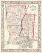
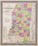
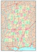
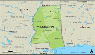
Μισισίπι (Mississippi)
 |
 |
Το όνομα της πολιτείας προέρχεται από τον Ποταμό Μισσισσιππή, που κυλά κατά μήκος του δυτικού του συνόρου, και παίρνει το όνομα του από την λέξη των Οτζίμπουε misi-ziibi («Μεγάλος Ποταμός»).
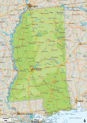
Η πολιτεία είναι αρκετά δασώδης έξω από την περιοχή του Δέλτα του Μισισιπή. Τα ιχθυοτροφεία γατόψαρου της πολιτείας παράγουν την πλειονότητα των γατόψαρων που καταναλώνονται στις Ηνωμένες Πολιτείες. Το σύμβολο της πολιτείας είναι το δέντρο της μανόλιας.
Το Μισισίπι έχει υγρό υποτροπικό κλίμα με μακριά καλοκαίρια και βραχείς, ήπιους χειμώνες. Οι θερμοκρασίες είναι κατά μέσον όρο 95°F (περίπου 35°C) τον Ιούλιο και περίπου 48 °F (περίπου 9 °C) τον Ιανουάριο. η θερμοκρασία ποικίλει λίγο σε πολιτειακό επίπεδο το καλοκαίρι· όμως, τον χειμώνα, η περιοχή κοντά στην Θαλάσσια Περιοχή του Μισισίπι είναι σημαντικά θερμότερη από το εσωτερικό τμήμα της πολιτείας. The recorded temperature in Mississippi has ranged from −19 °F (−28.3 °C), in 1966, at Corinth in the northeast, to 115 °F (46.1 °C), in 1930, at Holly Springs in the north. Heavy snowfall is possible across the state, such as during the New Year's Eve 1963 snowstorm. Yearly precipitation generally increases from north to south, with the regions closer to the Gulf being the most humid. Thus, Clarksdale, in the northwest, gets about 50 inches (about 1,270 mm) of precipitation annually and Biloxi, in the south, about 61 inches (about 1,550 mm). Small amounts of snow fall in northern and central Mississippi, although snow is occasional in the southern part of the state.
The late summer and fall is the seasonal period of risk for hurricanes moving inland from the Gulf of Mexico, especially in the southern part of the state. Hurricane Camille in 1969 and Hurricane Katrina in 2005, which killed 238 people in the state, are the most devastating hurricanes to hit the state, both causing nearly total storm surge damage around Gulfport, Biloxi and Pascagoula. As in the rest of the Deep South, thunderstorms are common in Mississippi, especially in the southern part of the state. On average, Mississippi has around 27 tornadoes annually; the northern part of the state has more tornadoes earlier in the year and the southern part a higher frequency later in the year. Two of the five deadliest tornadoes in US history have occurred in the state. These storms struck Natchez, in southwest Mississippi (see The Great Natchez Tornado) and Tupelo, in the northeast corner of the state. About seven F5 tornadoes have been recorded in the state.
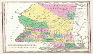
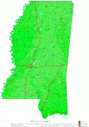
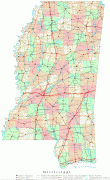
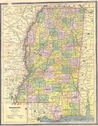
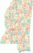
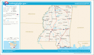
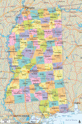
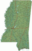
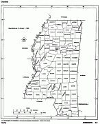
Χάρτης - Μισισίπι (Mississippi)
Χάρτης


Χώρα - Ηνωμένες Πολιτείες Αμερικής
 |
 |
| Σημαία των Ηνωμένων Πολιτειών | |
Η ομοσπονδιακή πρωτεύουσα των ΗΠΑ, είναι η Ουάσινγκτον Π.Κ., ενώ η μεγαλύτερη πληθυσμιακά πόλη και το σημαντικότερο οικονομικό της κέντρο, είναι η Νέα Υόρκη. Άλλες σημαντικές πόλεις της χώρας, είναι το Λος Άντζελες, το Σικάγο, το Χιούστον, το Ντάλας, η Ατλάντα, το Σαν Φρανσίσκο, η Φιλαδέλφεια, η Βοστώνη, το Μαϊάμι και το Σιάτλ.
Νομισματική μονάδα / Γλώσσα
| ISO | Νομισματική μονάδα | Σύμβολο | Significant Figures |
|---|---|---|---|
| USD | Δολάριο ΗΠΑ (United States dollar) | $ | 2 |
| ISO | Γλώσσα |
|---|---|
| EN | Αγγλική γλώσσα (English language) |
| FR | Γαλλική γλώσσα (French language) |
| ES | Ισπανική γλώσσα (Spanish language) |


